Monday, April 14, 2014

Predictable

Have you ever heard of a West Texas hurricane? Me neither, but apparently they exist. We have yet to experience one because we stayed in Davis Mountains State Park last night rather than fight the predicted 75-mile-an-hour gusts in Guadalupe Mountains National Park today. We asked several locals in Fort Davis if such straight-line winds were even possible outside of a blizzard, tornado, or other associated storm. They all shrugged and said sure.  

But an extra day in the Davis Mountains was no sacrifice, really. It gave Rex the opportunity to visit McDonald Observatory while I researched and attempted a little trail running. We also were happy to keep the best campsite in the park: We’re in the equine lot, referred to as “horse camp” in most public areas. There’s a locked gate at the top of the drive, and we cannot see the road from our campsite. There’s no water or electricity, but we need neither because we have our own. What we don’t have is neighbors save for the occasional birder, and we love to chat up these folks.

The birders are drawn to a short trail that leaves from our parking area and travels to a water seep about ¼ mile away.  Birds are drawn to the water and so are flying insects. Two evenings in a row, in exactly the same spot, we watched a hooded warbler dance for as it feasted. Of course, the bird was not really dancing for us, and it seemed obviously to our presence as we sat mesmerized for at least 20 minutes each night, leaving each time only because of increasing chill and darkness. Nothing in nature is perfectly predictable, but I’m fairly certain that bird can be found there every evening—at least until it’s brood is out of the nest. 

Rex and I, on the other hand, will be leaving the Davis Mountains tomorrow. I predict there will be wind. It is West Texas, mind you. 

Whitey, TI, and Rex in the primitive equestrian camping area, Davis Mountains State Park

Saturday, April 12, 2014

Little Gems

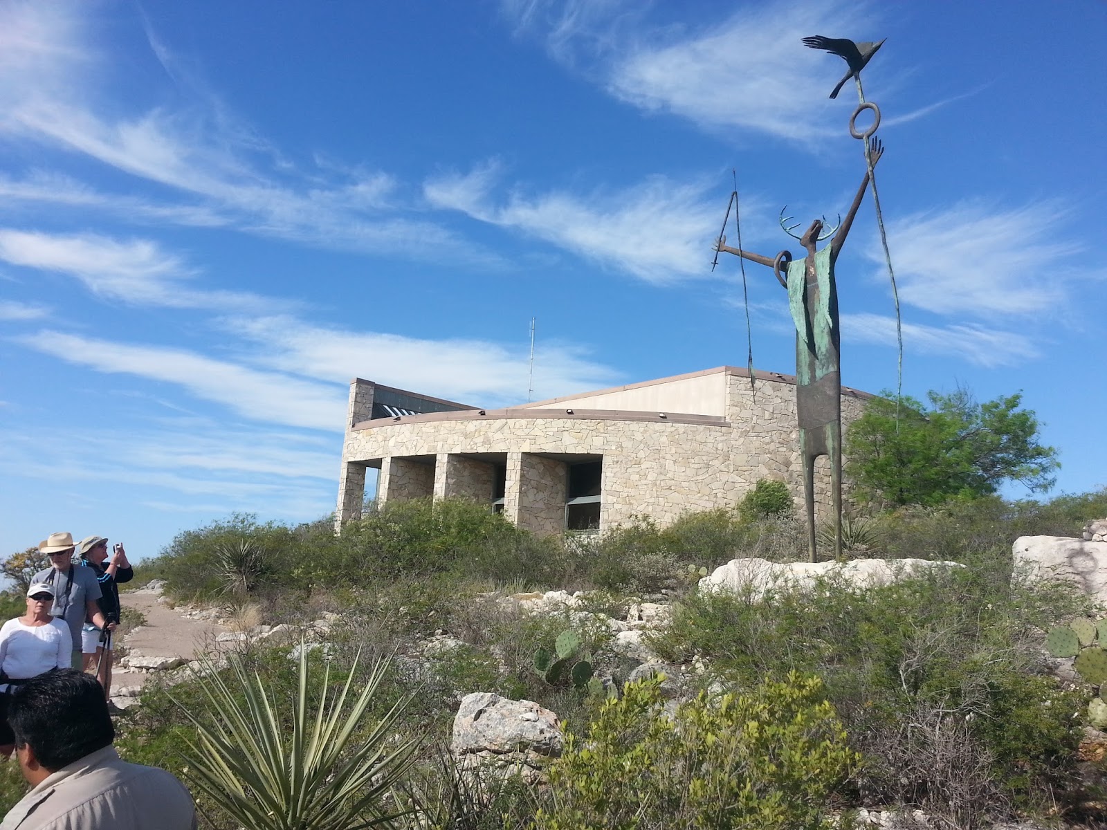
State parks are little gems. We especially recommend Seminole Canyon State Park, our latest discovery. 

A state historical park, Seminole Canyon protects and shares archaeological resources, most notably a series of canyon-wall paintings that are about 4,000 years old. Most of the drawings can only be seen on a $5-per person guided tour of the canyon. We found it to be well worth the hour and half. Our knowledgeable guide told fascinating stories and could answer almost any question. I’d do the tour again just to be able to bird in the canyon.


Speaking of birds, the flora and fauna of the park deserves closer inspection, too. You can do so on about 10 miles of trails, most of which are perfect for fat-tire biking, with no hard-tail experience required. If I was a native flower expert, I would name more than a dozen for you that are blooming now. The lime-green cast of the newly leafed mesquites is exquisite as well. I can tell you that we saw more than a dozen different bird species in just over 28 hours in the park, including lark buntings, black-tailed gnatcatchers, black-throated sparrows, road runners, and wood ducks.  

For those who love desert environments, Seminole offers a smaller, more accessible version of Big Bend National Park. Seminole is two hours closer to Austin, for example. And if you don’t like Seminole, well, you probably shouldn’t waste your time trekking to Big Bend. 


Note that we took I-35 to San Antonio, then drove west on US-90 through Uvalde and Del Rio. We’re heading for the Davis Mountains and Guadalupe Mountains National Park, so taking US-90 rather than I-10 is out of our way. But we have no regrets: We would have missed Seminole Canyon, and US-90 offers no traffic and amazing views. Plus it’s a pretty good road. On the other hand, I don’t have any good advice on getting through San Antonio during rush hour. We took the outer loop—FM 1604—and we would not do that again.  


Tuesday, April 1, 2014

Back at it


Greeting friends, family, and the otherwise curious. Rex and I went into hibernation for several months, but the lengthening days brought us out of our den. We currently are in Central Texas and will be for several more days. 

Sometime in early April we will point our truck and fifth wheel west, heading toward the Four Corners. Our goal is to hike and bike Utah before the summer heat becomes too intense, then return to our new home in Kansas for the summer. 

And yes, “home in Kansas” does mean that “no permanent address” is a misnomer. We closed on a house in Manhattan on February 14 and moved in that same day.  More on that later. 

But while we can no longer claim to be living exclusively in a 300-square-foot trailer, we decided to continue this blog for the remainder of our travels. After living without a stable address for almost a year, we discovered that transitory living promotes some helpful habits. I intend to highlighting these benefits as we also keep you posted on the places we visit. 

For now, here's some photos of springtime Austin, hands down the most wonderful time to be here.  

Tuesday, October 1, 2013

City by the Bay


While Colene flew to Austin to defend her dissertation in August, I got to stay in San Francisco with my niece Faith Bolliger and her fiancĂ©, Dan Ross. They were gracious hosts, letting me have my space so I could bum around all week. I promised Colene that I would work on our 2012 taxes while we were apart, but I later realized our extension wasn’t up until October--so what was the rush?


So one day I biked downtown and up the hill to Coit Tower. Yes, I had to push my bike up the last hill. It was so steep I wouldn’t have trusted my bike brakes to ride down it!


I didn’t go to the top of Coit Tower, but I did enjoy the murals around the base as well as the view from Telegraph Hill. As an added bonus, I watched a dozen pygmy nuthatches playing in the trees on the hill. I had never before seen pygmy nuthatches, and so far, I have only seen them in San Francisco.


One of the big events in San Francisco this year was the America’s Cup. Because the United States won the last race in 2010, the U.S. got to pick the location of this year’s race, and they chose San Francisco. I admittedly do not know much about it, but the location seems ideal to me. On many race days the wind was at or over the racing limit, meaning the boats would be very fast. And isn’t that what spectators want--speed and lots of potential danger? Overall, this is a wild, precarious sport. As I heard someone say, if the boats don't fall apart after the last race, they were built too strong and heavy. 


While I was in town the teams were still competing for the Louis Vuitton Cup, which is the series of races that determines who will challenge the defending champion. This year, the New Zealand team won the Vuitton Cup rather handily. 

Here are some things I learn about the America's Cup after a few days of watching and talking to volunteers:

  • The boats are a lot bigger than I imagined. At 72’ long and 46’ wide, they are about the size of a junior-high basketball court. In addition, the mast are 131’ tall.
  • It takes a tall crane to assemble the boats. First they raise the sail and set it on the hull. Then they lift the sail and hull so that the rudders can be installed, then finally lift the complete boat into the water.
  • One Saturday morning I visited with a father and son from New Zealand while fewer than 100 other people watched the race. The Kiwis said that if the race had been taking place in New Zealand, 10,000 spectators would have been at the dock.
  • The race doesn’t take place every year; race participants negotiate when the next race will happen. There was once a 20-year span between races.
  • The wind can’t be over a certain speed or the race will be postponed or cancelled.
  • The competition was started in 1851, making it the oldest active trophy in international sport. 


Once the competition for the America's Cup began between New Zealand and the United States, I was mostly out of touch--no cell phone or internet. I was shocked to learn, after the fact, that the U.S. team came from behind to win it again. The Kiwis must have been bitterly disappointed. 

Monday, September 30, 2013

Trail Less Traveled

Rex and I have been remiss in keeping up this blog, obviously. We soon will be moving into a new phase of our on-the-road adventure, so I’m now motivated to bring this online report up-to-date. Since we left Santa Rosa, California, on September 1, we have traveled only 750 miles to Yosemite, Sequoia, and Kings Canyon National Parks, then south to the Los Angeles.

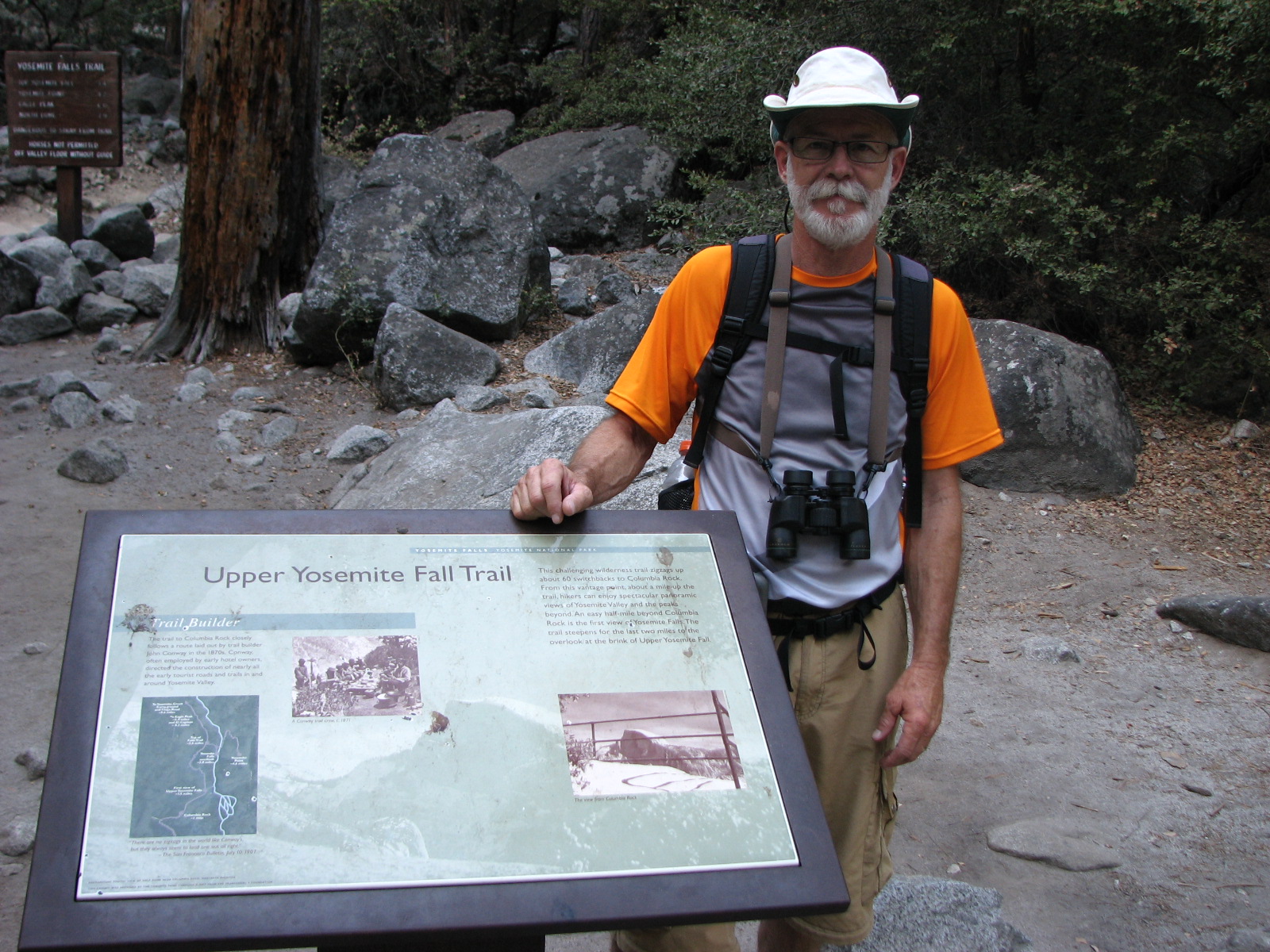
On the other hand, we have covered quite a bit of ground. While in Yosemite Valley September 1 through 7, we completed several hikes, including the magnificent Panorama and Sentinel DomeTrails, but our personal favorite was the Yosemite Falls Trail.

We were silly enough to take on this strenuous feat when the falls were bone dry. Fed by spring snow melt, North America’s tallest waterfall goes dry every summer, usually in August. But with only 30 percent of normal snowfall last winter, the falls stopped running in June this year. Nevertheless, we decided to try this trail, partly because we liked the challenge (only 8.5 miles round trip but a 3,400' climb) and partly because we wanted a southern view of the valley.

Thankfully, we were rewarded for our folly: We had the trail almost to ourselves, the views were stunning, and we stumbled into some excellent birding along the way. I’m certain people flock to this trail when the water is flowing, but in my mind, it’s worth the walk any time of year, and maybe even more so in late summer, thanks to the solitude.
Early start, on our way up


Not just Rex, but Colene, too, had many hands-on-hips moments as we inched our way to the top.  The engineering and construction on this trail were phenomenal. 


Break time


This is all that remains of Yosemite Creek on September 5. In the spring, it gushes with snow melt and falls 5,404 feet to the valley floor.  Even so, there was enough water to attract birds. Not far from here, we lingered for more than an hour while watching Cassin's finches, white-headed woodpeckers, and black-throated grey warblers-- just few of the species we spotted. 

At the top: Half Dome from Yosemite Point


On our way down

Rock climbing is a big deal in Yosemite.  I had no idea that this sub-culture even existed, but that's clearly what it is. Here, we encountered two climbers laying a new trail. 

The view from Columbia Rock, only a few miles up the trail.  If one can't make it to Yosemite Point, hoofing it as far as Columbia Rock is a good alternative. 

The end.

Our route

Friday, August 30, 2013

Gotta do it once

Rex comes up with the greatest schemes. In his latest, he found a good reason to drive California State Route 1: we needed a spotting scope.

Route 1, the famous coastal road from that runs from Mendocino County to Orange County, does not accommodate 30-foot trailers. When we came south from Crescent City, we took the faster, straighter US 101. But the incomparable Route 1 calls. So when two different birding couples mentioned Out of This World in Mendocino as a great source for spotting scopes, Rex's wheels started turning. He has shopped the powerful optic aids for weeks, and sure enough, when we called, James the helpful clerk told us that he did have a Nikon ED50 in stock--just what we have been wanting.  Preordained, right?

So on Tuesday, we headed north then northwest, driving over the hills on a very crooked road toward Boonville and on to Mendocino. Once we accomplished our business, we took a too-short tour of the town and ate our lunch overlooking the ocean then followed the coast south.

Here's a link to the route we followed, and a few photos are posted here. The entire 200-mile journey took 13 hours. We don't need to ever drive that road again, but I am so very glad we did.  Enjoy the slideshow!

Sunday, August 25, 2013

Plan B

UPDATE: As we expected, the National Park Service has now closed indefinitely Hodgdon Meadows Campground, where we were to stay through September 3rd. According to the NPS, most of park remains open and smoke-free. Rex and I have decided to go to the south side of Yosemite on Thursday, in hopes of finding a spot in a "first-come, first served" campground.


What do we do when the 15th largest wildfire in California history closes the Yosemite campground we reserved four months ago? We go to Plan B: bikes, birds, and beer.

After reuniting in San Francisco last Saturday and retrieving our fifth wheel, the TI, from storage on Sunday, we intended to regroup in Santa Rosa for a few days before heading east toward Yosemite, where a campsite had our name on it, starting August 22nd.

But Santa Rosa is a very comfortable town--maybe not as easy as Austin, which I've heard Alejandro Escovedo aptly call the Velvet Rut. Still, the weather here is almost perfect, the streets are easy to navigate with car or bike, and the produce at the even the big-box stores is incredibly fresh, flavorful, and cheap.

Then there's the beer. Russian River is in Santa Rosa, Bear Republic in Healdsburg, and Lagunitas in Petaluma--three breweries with long-standing and well-deserved national reputations within 30 miles of each other.

Lagunitas employees really love their jobs.  In Petaluma, CA. 
By Thursday, we found ourselves still in Santa Rosa, and that was a good thing. Otherwise, we would have been halfway to Yosemite when we learned that our campground was closing due to the Rim Fire.

In our version of lemons-to-lemonade, we biked through wine country on Friday. I've mapped out our 25-mile loop here. Most of it was low- or slow traffic, but some sections were too dangerous for bicyclists, no matter what the Sonoma Cycling Club says. We would do it again but incorporate more of Dry Creek Road into our route--and more wineries. We only made it to one thought there were at least three dozen offering tastings on our loop.
Vineyard on West Dry Creek Road near Yoakim Bridge Road

Another vineyard, same general location
Harvest time?
Rex re-hydrating, Russian River valley south of Geyserville
Late Friday night after our ride, curiosity got the best of me and I went looking online for the local Audubon chapter. Sure enough, one of the premiere birding sites in the country--Bodega Bay--is only 25 miles away. And wouldn't you know it, but the Madrone Audubon Society would be hosting a guided walk there on Saturday at 7:30 am. We were out the door by 6:35 the next morning and had an absolutely amazing day: 17 life-list bird and 48 species sighted in total.
Bodega Head; here we saw pelagic cormorants, Brandt's cormorants, wandering tattlers, and a common murre, to name a few. Many, many thanks to Gordon Beebe and all the Audubon regulars for patiently sharing so many magical birds with us. 

On our return trip from Bodega Bay, we made two stops in Sebastopol: the Luther Burbank Experiment Farm and a month-old brewery and restaurant called Woodfour Brewing Company.

Did you ever think about the origins of Shasta Daisy? Me neither--until I visited Luther Burbank's farm and learned that the horticulturalist created this white-and-yellow favorite. I assumed the Shasta Daisy had been with us since God formed dry land, but Burbank introduced it in 1901. It is one of more than 800 new plants that he produced in his life time, including the first commercially grown cherry and dozens of other improved flowers, nuts, fruits, and vegetables. A worthy legacy, if you ask me.  
Rex inspects some of Luther Burbank's work: an experimental chestnut. 

We still don't know when we will leave Santa Rosa, But we will make the best of it, I am certain of that.
A Berliner weisse at Woodfour Brewing Company. Skip it and go for the Belgium dubbel instead.