Monday, April 28, 2014

Next Stop: Horsethief Campground

Colorado River just west of Moab, UT
Friends and family, here’s a quick update from Utah.  

We left Moab this morning, looking for a campsite. We struck out along the Colorado River just outside of town--no sites available. We settled instead for a BLM campground off UT-313. Called Horsethief, it sits at 5759 feet and is halfway between Arches National Park and the Island in the Sky District of Canyonlands National Park. It’s a really swell place, picturesque and peaceful, even if the wind is gusting up to 50 mph right now. We’re very happy here and plan to stay here as long as we explore these two national parks. 

Again, we only have a modicum of internet access, but enough to check email and blog. Even better, we have very good cell-phone service, so please call or text.  If we don’t answer right away, we’re probably hiking somewhere. 

Forecast tonight: Freeze warning, low of 29, wind gusts to 45. Thank goodness for propane!

Sunday, April 27, 2014

Canyonlands Kodachrome

Friends and family, we left the Needles District of Cayonlands National Park yesterday. We hated to leave, but at the same time, after six days and 30 miles of hiking we felt it was time. Plus, we know there is more to see in Utah.

I've put 30 of our best Needles District photos on Picasa. You can view them here. We of course have lots of stories from Canyonlands, but we wanted you to see the photos right away. More postings to come.

Meanwhile, we're now in Moab, restocking the fridge, cleaning our clothes, and planning our next move. Moab is an interesting place--not at all what we thought it would be, though we tried to keep our preconceived notions at bay. Nevertheless, we did have expectations, shaped mostly, I think, by Colorado mountain towns. And that Moab isn't, in good and bad ways. More about that later.

Tomorrow, we hope to find a BLM campsite just outside of town. Once again we'll need some Fowles luck--these sites are close to both Arches NP and Canyonlands Island in the Sky District, plus they are on a scenic stretch of the Colorado River. We'll let you know how it turns out.  Missing you all.

Tuesday, April 22, 2014

Made it to Utah

For the record, Rex and I drove into Utah on Easter Sunday. April 20th also happened to be Rex’s birthday, and he was given a very fine gift: an open campsite in the Needles District of Canyonlands National Park. We knew we were lucky to secure one of only 26 sites--which are available solely on a first-come, first-served basis. But as we set up camp and watched dozens of people driving by, looking for a site, we realized how fortunate we in fact were. We plan to stay here through Friday night.

We could not be happier with our campsite, #2 in Squaw Flats, Loop A. It’s near all of the main trailheads and affords an unbelievable 360-degree panorama of the surrounding mountains and bluffs. Unfortunately, we cannot now show you the view. We happen to be camped in one of the few places within the park with a modicum of cell-phone access, but we are unable make phone calls, upload photos, or surf the Web. Emails and simple text uploads seem to max out the available bandwidth.

On Monday, we walked to the confluence of the Green and Colorado Rivers--the first of what we hope will be three epic day hikes in the Needles District. This first walk certainly lived up to its billing. The overlook offered a striking view, but frankly, the hike itself, not the destination, was the best reward. It is very hard to describe the abstract sandstone forms that populate this place, let alone the full palette of colors, vibrant desert plants, living soils, etc. Again, please stay tuned for the photos.


I’ll close for now with a unfairly brief summary of our trek across New Mexico, which deserves more exploring, too. We chose a rather circuitous route, following the last-minute advice of a U.S. Forest Service officer in Carlsbad. From Carlsbad, we went north to Artesia, then mostly west into the Lincoln National Forest. We stayed one night in Mayhill, then drove NM 130 into Cloudcroft. At 8,779 feet elevation, this village deserves further exploring. Unlike most Colorado mountain towns, Cloudcroft does not feel lousy with urban money and retains its Western edge. We then looped back north and west to Ruidoso Downs and Hondo, took an (awful!) US 380 to Captain, made a surprisingly worthwhile stop at the Smokey Bear Historical Museum, and found better road and an excellent BLM campground on the way to Carrizzo. The next day we made a final, hard push for the Four Corners, driving 410 miles to Socorro, Grants, Gallup, and Shiprock, crossing into Colorado not long before the sunset and making camp in Cortez. Phew! Not the way we prefer to travel, but we saw enough to want to go back to the Enchanted State.  

Thursday, April 17, 2014

Hike to Hunter Peak

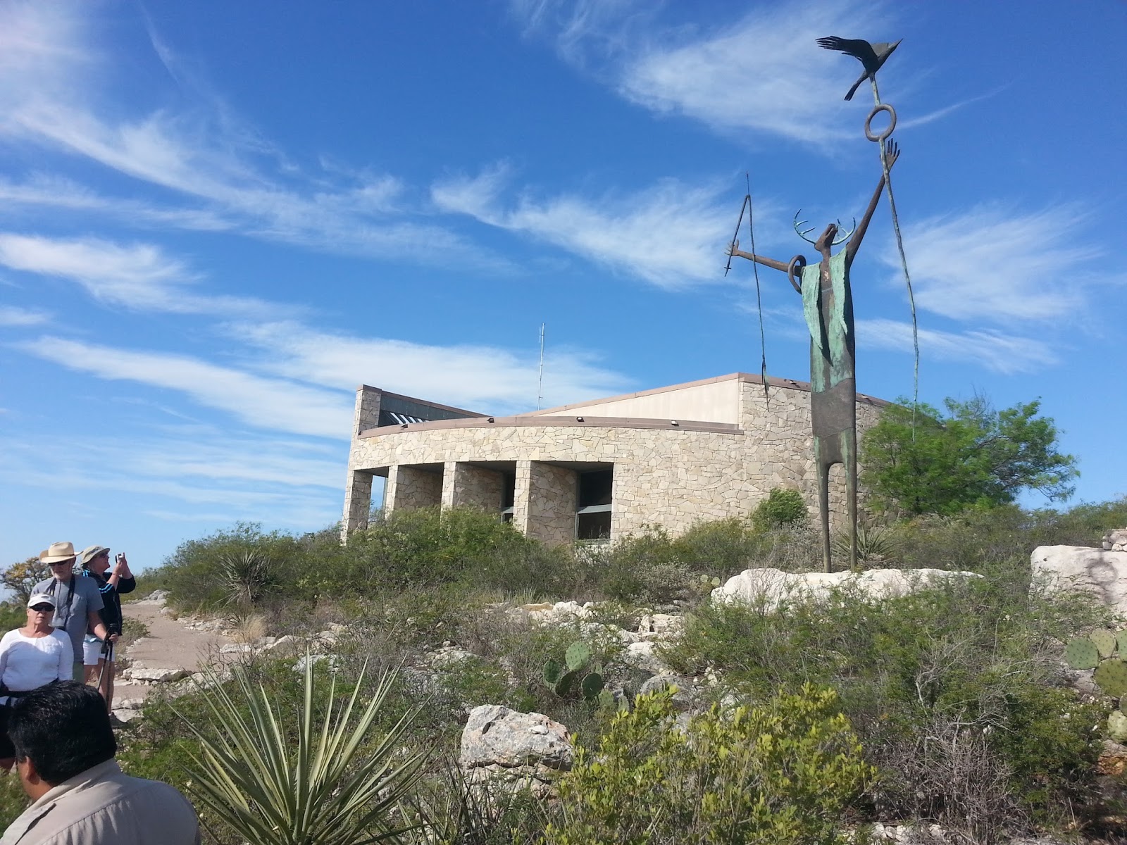
We stopped at Guadalupe Mountains National Park with the specific intention of hiking to the top of Texas. We had been to the national park before, loved it, and wanted to climb Mount Guadalupe, the tallest peak in Texas. We are not peak baggers, but we knew it would be a challenging hike with amazing views.

But once we arrived at the park, a different mood struck us. Maybe it was the forecast for high wind. Or perhaps we sensed that the road less traveled might be the better option. For whatever reason, we decided to forgo Guadalupe Peak and instead walk a different loop--same distance, almost the same elevation gain, but more of an unknown.

We don't know what we missed on Guadalupe Peak, but we absolutely loved our chosen route. First, it led us into a high-elevation forest of pines and firs--completely different than the desert environment at lower elevations. Second, the hike took us down Bear Canyon, which at the time did not seem like a plus. But after completing our two-hour descent, we felt incredibly accomplished. It is hands-down the steepest, rockiest, most challenging trail we have ever traversed. The canyon is so sharp and narrow that, from the bottom, it's very hard to imagine that humans could walk down it. Third--and this is the most amazing part--we saw exactly zero other hikers while on the trail. More than 8.5 miles and almost eight hours of hiking, and not a soul.

The birds were a little scarce, too, but we did greatly enjoy the acrobatics of violet-green swallows, as well as rock wrens, canyon wrens, and black-chinned sparrows.

More photos here, which, as always, cannot do justice to the place. Go see for yourself.


Monday, April 14, 2014

Predictable

Have you ever heard of a West Texas hurricane? Me neither, but apparently they exist. We have yet to experience one because we stayed in Davis Mountains State Park last night rather than fight the predicted 75-mile-an-hour gusts in Guadalupe Mountains National Park today. We asked several locals in Fort Davis if such straight-line winds were even possible outside of a blizzard, tornado, or other associated storm. They all shrugged and said sure.  

But an extra day in the Davis Mountains was no sacrifice, really. It gave Rex the opportunity to visit McDonald Observatory while I researched and attempted a little trail running. We also were happy to keep the best campsite in the park: We’re in the equine lot, referred to as “horse camp” in most public areas. There’s a locked gate at the top of the drive, and we cannot see the road from our campsite. There’s no water or electricity, but we need neither because we have our own. What we don’t have is neighbors save for the occasional birder, and we love to chat up these folks.

The birders are drawn to a short trail that leaves from our parking area and travels to a water seep about ¼ mile away.  Birds are drawn to the water and so are flying insects. Two evenings in a row, in exactly the same spot, we watched a hooded warbler dance for as it feasted. Of course, the bird was not really dancing for us, and it seemed obviously to our presence as we sat mesmerized for at least 20 minutes each night, leaving each time only because of increasing chill and darkness. Nothing in nature is perfectly predictable, but I’m fairly certain that bird can be found there every evening—at least until it’s brood is out of the nest. 

Rex and I, on the other hand, will be leaving the Davis Mountains tomorrow. I predict there will be wind. It is West Texas, mind you. 

Whitey, TI, and Rex in the primitive equestrian camping area, Davis Mountains State Park

Saturday, April 12, 2014

Little Gems

State parks are little gems. We especially recommend Seminole Canyon State Park, our latest discovery. 

A state historical park, Seminole Canyon protects and shares archaeological resources, most notably a series of canyon-wall paintings that are about 4,000 years old. Most of the drawings can only be seen on a $5-per person guided tour of the canyon. We found it to be well worth the hour and half. Our knowledgeable guide told fascinating stories and could answer almost any question. I’d do the tour again just to be able to bird in the canyon.


Speaking of birds, the flora and fauna of the park deserves closer inspection, too. You can do so on about 10 miles of trails, most of which are perfect for fat-tire biking, with no hard-tail experience required. If I was a native flower expert, I would name more than a dozen for you that are blooming now. The lime-green cast of the newly leafed mesquites is exquisite as well. I can tell you that we saw more than a dozen different bird species in just over 28 hours in the park, including lark buntings, black-tailed gnatcatchers, black-throated sparrows, road runners, and wood ducks.  

For those who love desert environments, Seminole offers a smaller, more accessible version of Big Bend National Park. Seminole is two hours closer to Austin, for example. And if you don’t like Seminole, well, you probably shouldn’t waste your time trekking to Big Bend. 


Note that we took I-35 to San Antonio, then drove west on US-90 through Uvalde and Del Rio. We’re heading for the Davis Mountains and Guadalupe Mountains National Park, so taking US-90 rather than I-10 is out of our way. But we have no regrets: We would have missed Seminole Canyon, and US-90 offers no traffic and amazing views. Plus it’s a pretty good road. On the other hand, I don’t have any good advice on getting through San Antonio during rush hour. We took the outer loop—FM 1604—and we would not do that again.  


Tuesday, April 1, 2014

Back at it


Greeting friends, family, and the otherwise curious. Rex and I went into hibernation for several months, but the lengthening days brought us out of our den. We currently are in Central Texas and will be for several more days. 

Sometime in early April we will point our truck and fifth wheel west, heading toward the Four Corners. Our goal is to hike and bike Utah before the summer heat becomes too intense, then return to our new home in Kansas for the summer. 

And yes, “home in Kansas” does mean that “no permanent address” is a misnomer. We closed on a house in Manhattan on February 14 and moved in that same day.  More on that later. 

But while we can no longer claim to be living exclusively in a 300-square-foot trailer, we decided to continue this blog for the remainder of our travels. After living without a stable address for almost a year, we discovered that transitory living promotes some helpful habits. I intend to highlighting these benefits as we also keep you posted on the places we visit. 

For now, here's some photos of springtime Austin, hands down the most wonderful time to be here.